
I’m Alex, and I’m an illustrator making maps & illustrations for websites, books, prints, posters and more.
I create campus maps for colleges and universities, site maps and floor plan illustrations for architecture and real estate, town maps, festival maps, walking maps and travel illustrations and guides.

Floor plan illustration for Welkin Apartments

Site map illustration for developments in Canada Water, London

New Jersey map illustration for a campaign for Rutgers University, including billboards and an interactive map
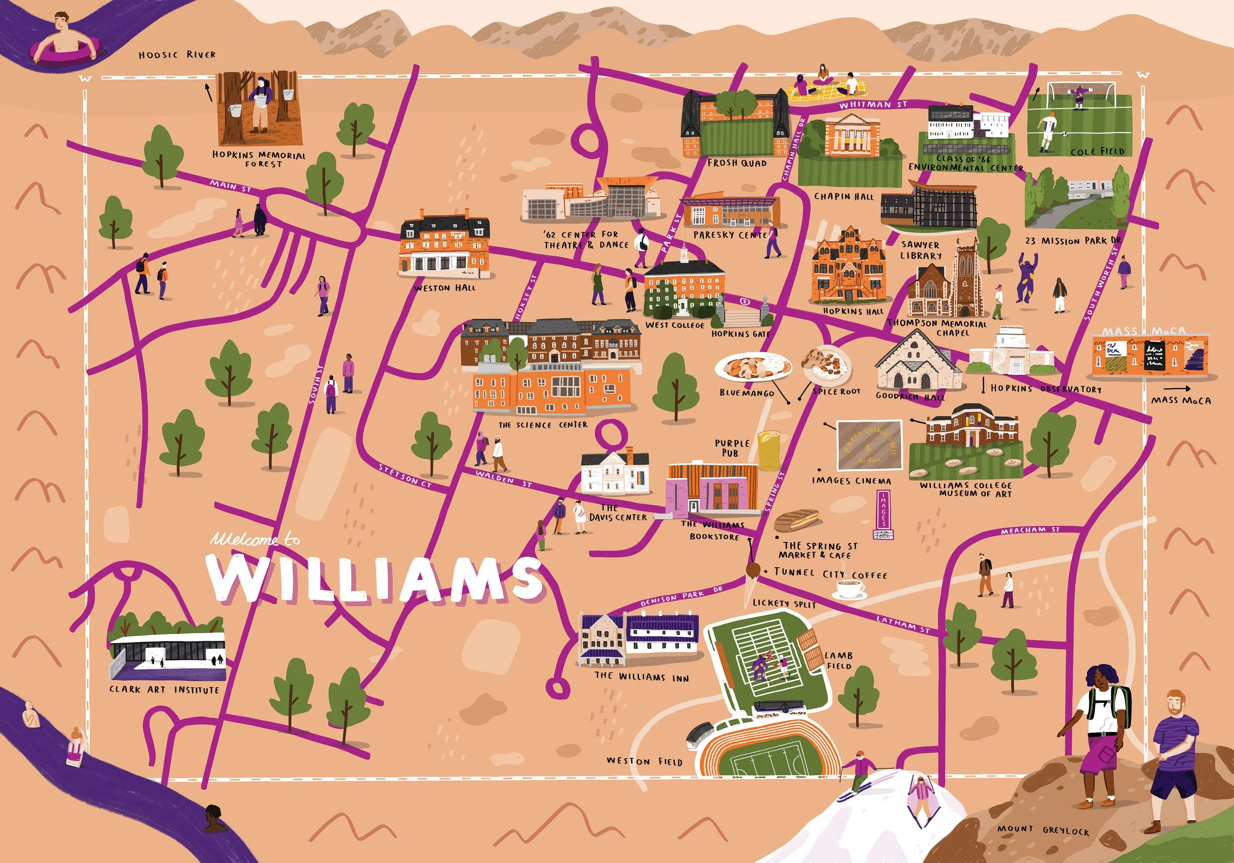
Campus map illustration - Williams College
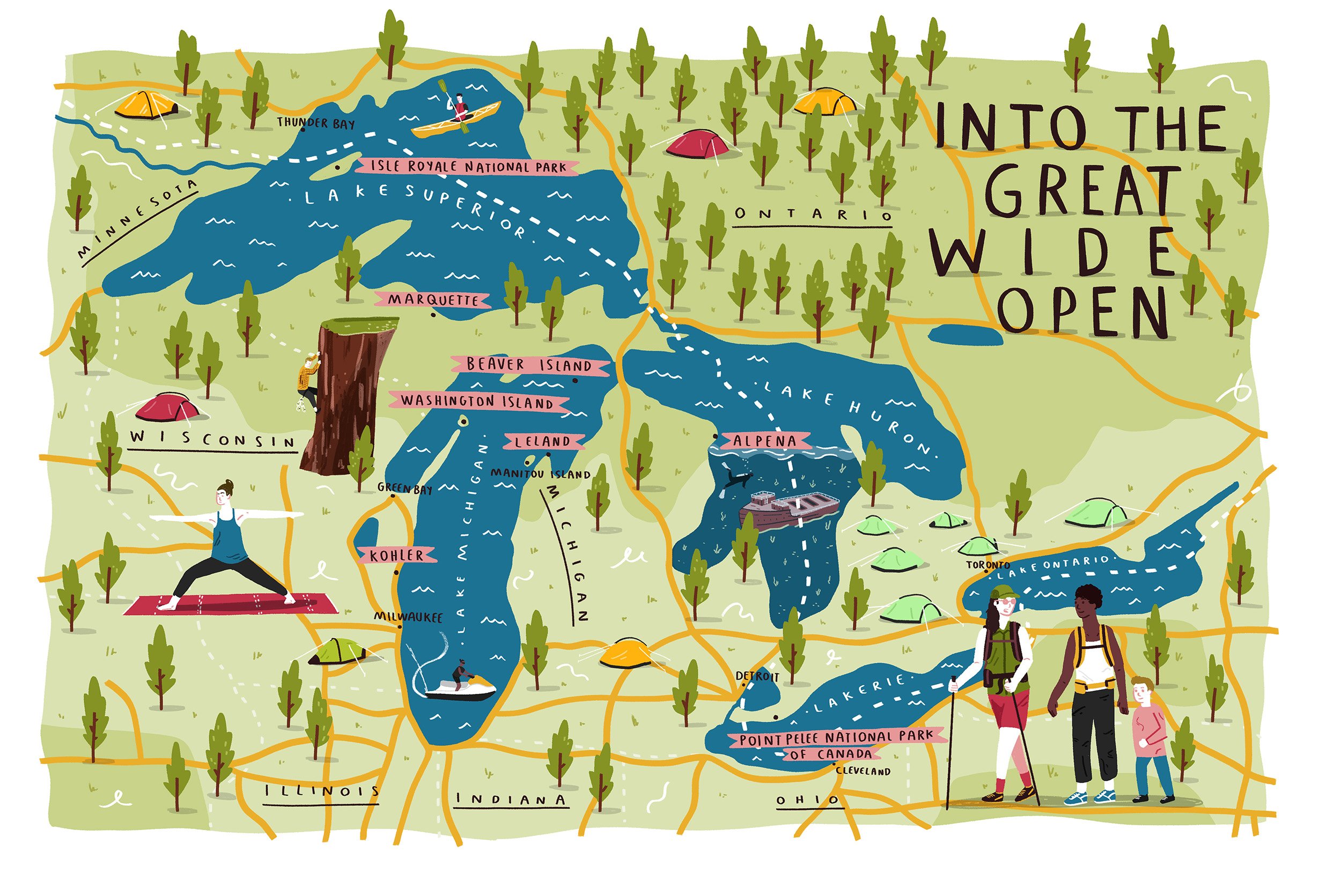
Chicago Magazine - Great Lakes map illustration

Melting Spots - a food map illustration of San Francisco, California. For the California Migration Museum

Campus map for new real estate at Emmanuel College, Cambridge University

Big Bend map illustration - Texas Highways Magazine

Architectural map for the Richmond Adelaide Centre, Toronto. Each building has a colour and texture associated with it according to the style guide.

Dog map of San Francisco for Paws & Play
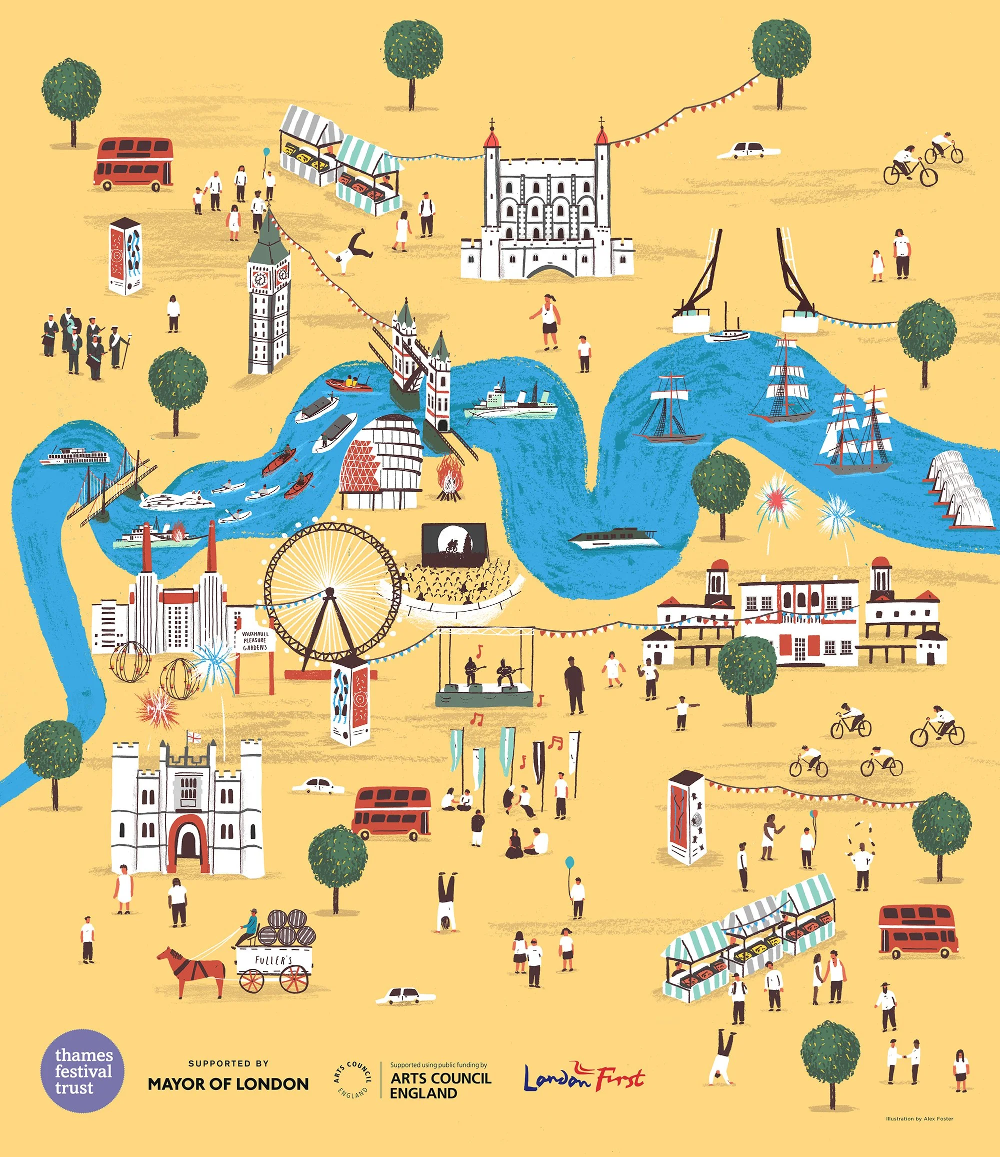
Totally Thames festival poster - World Illustration Award Winner

Spread & Cover for Illinois Alumni Magazine

Hand drawn typography for the Margate town map cover

The Margate Independent Business Map - my home town map of Margate

The Solar System print

Infographic design for Ards & North Down Borough Northern Ireland
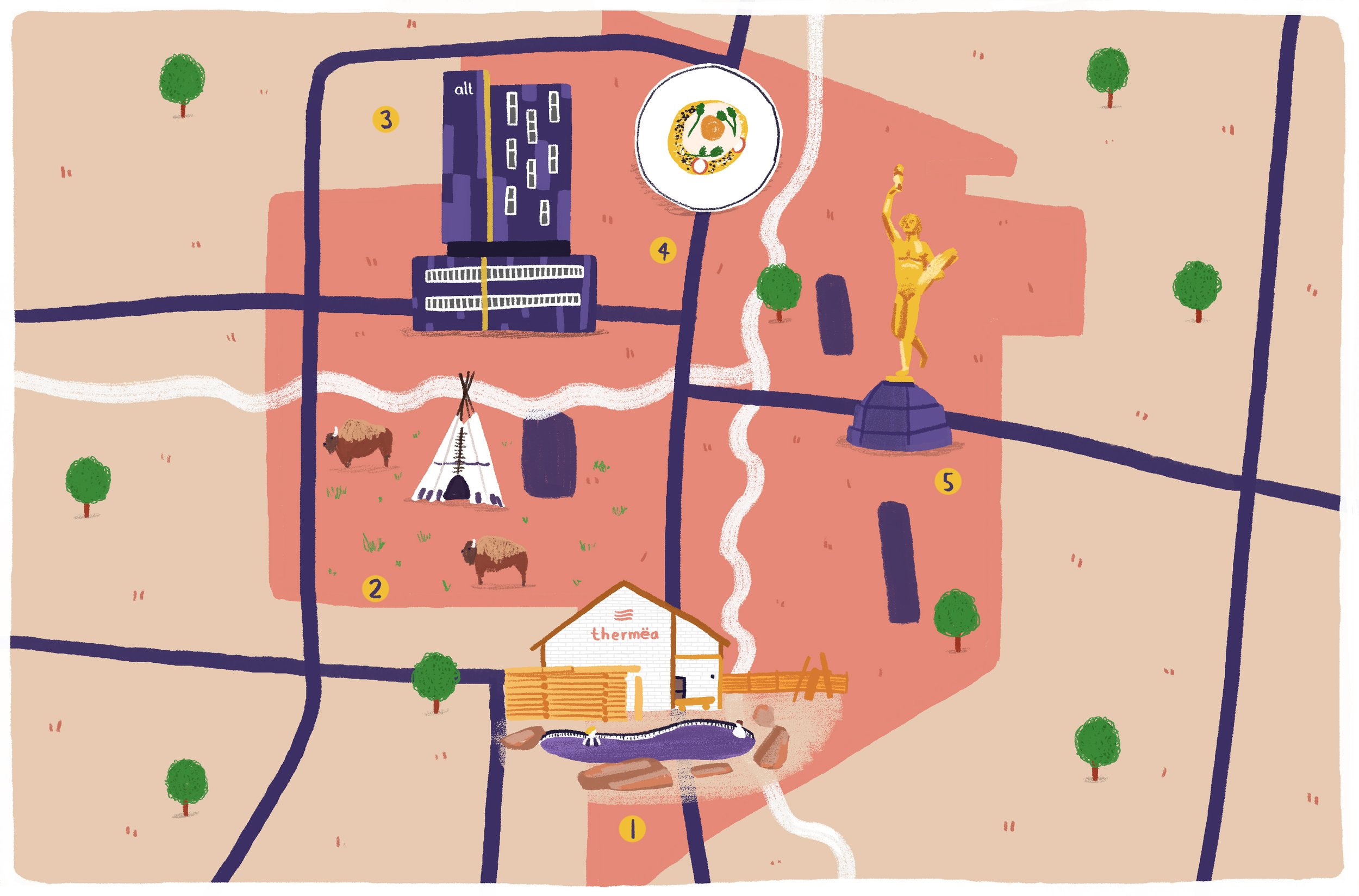
Winnipeg - Air Canada Magazine

Chattanooga, Tennessee - Air Canada Magazine
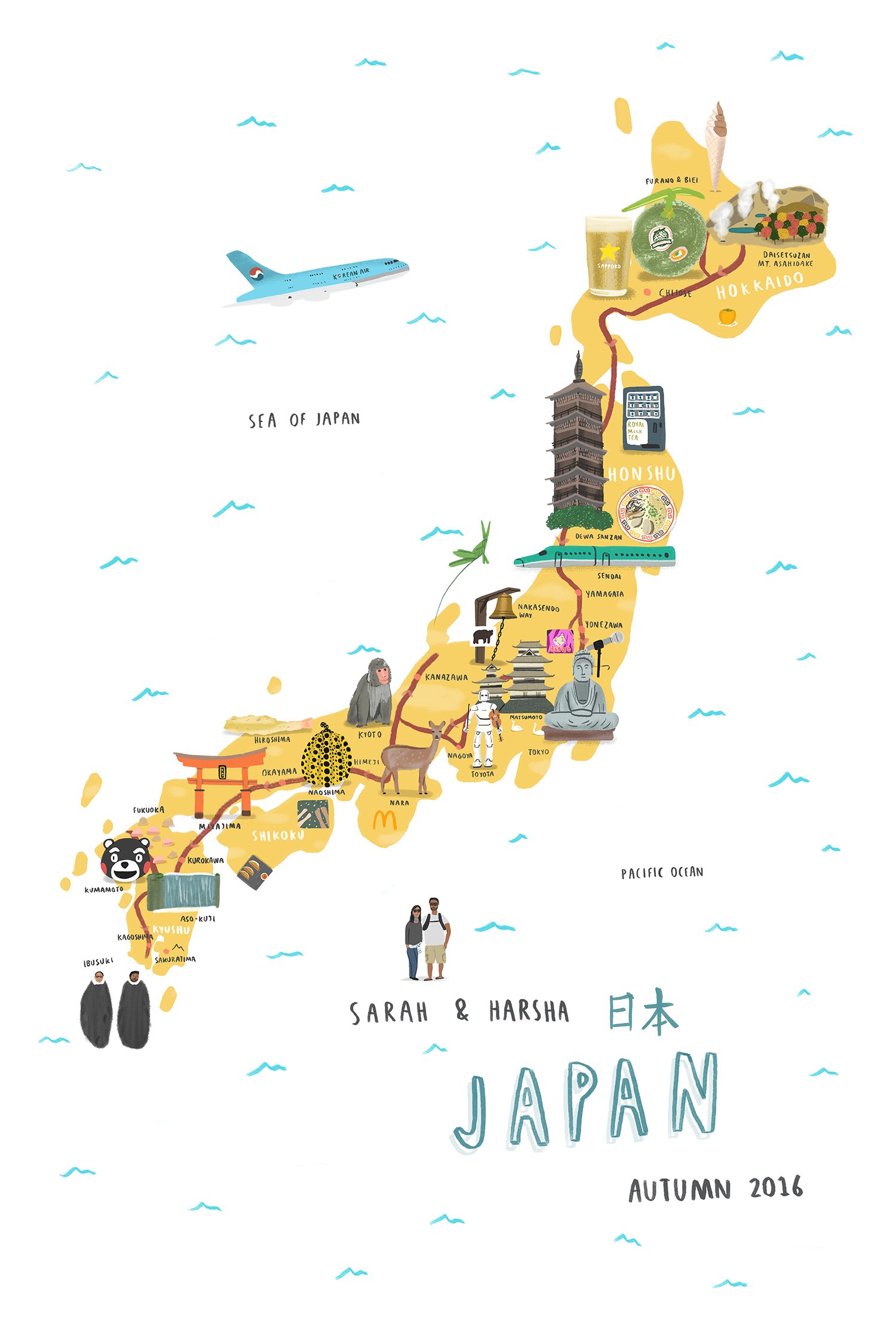
Japan Map Illustration - Personal Commission

India map - Flight Centre
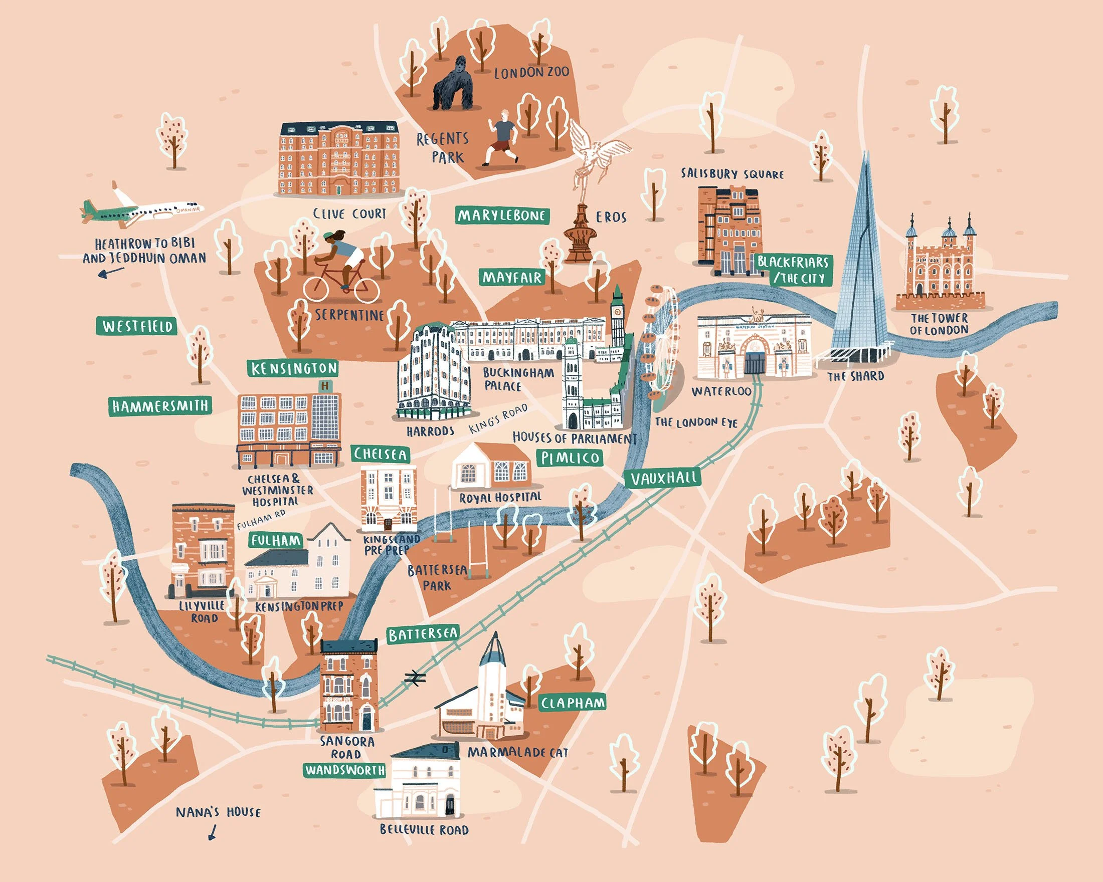
Personal map illustration of London

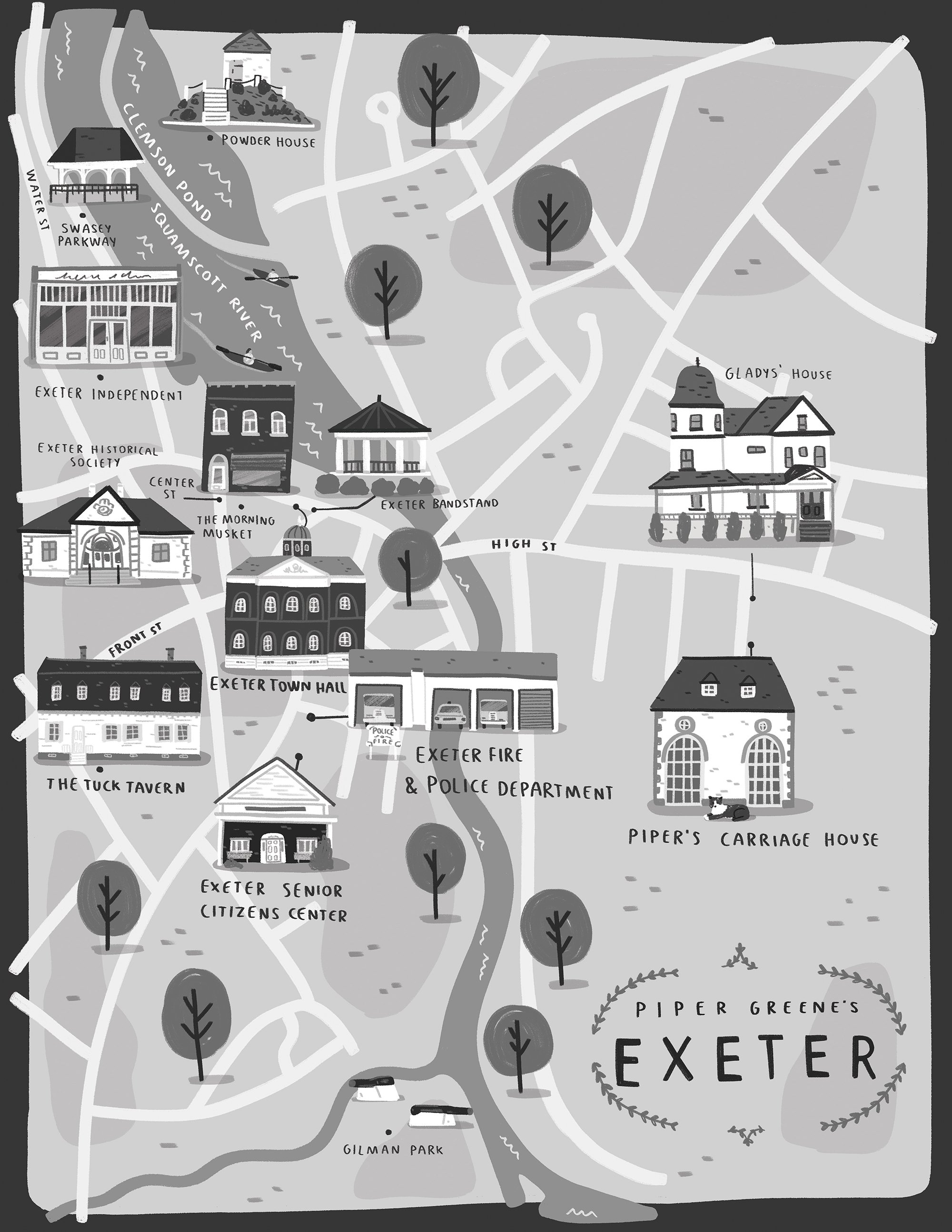
Town map illustration - Scholastic
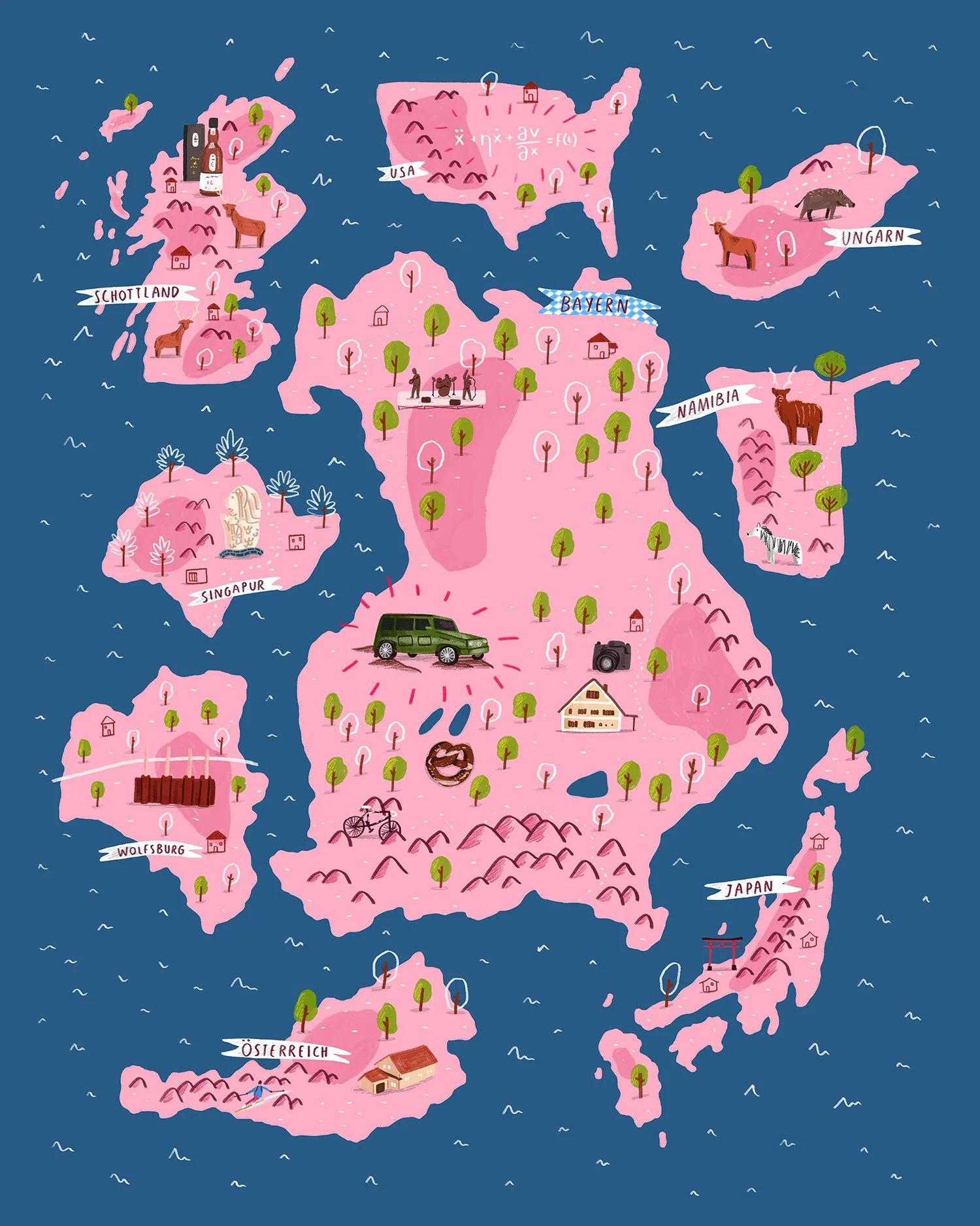
Personal map commission

Landscaping Illustration for Garden Design
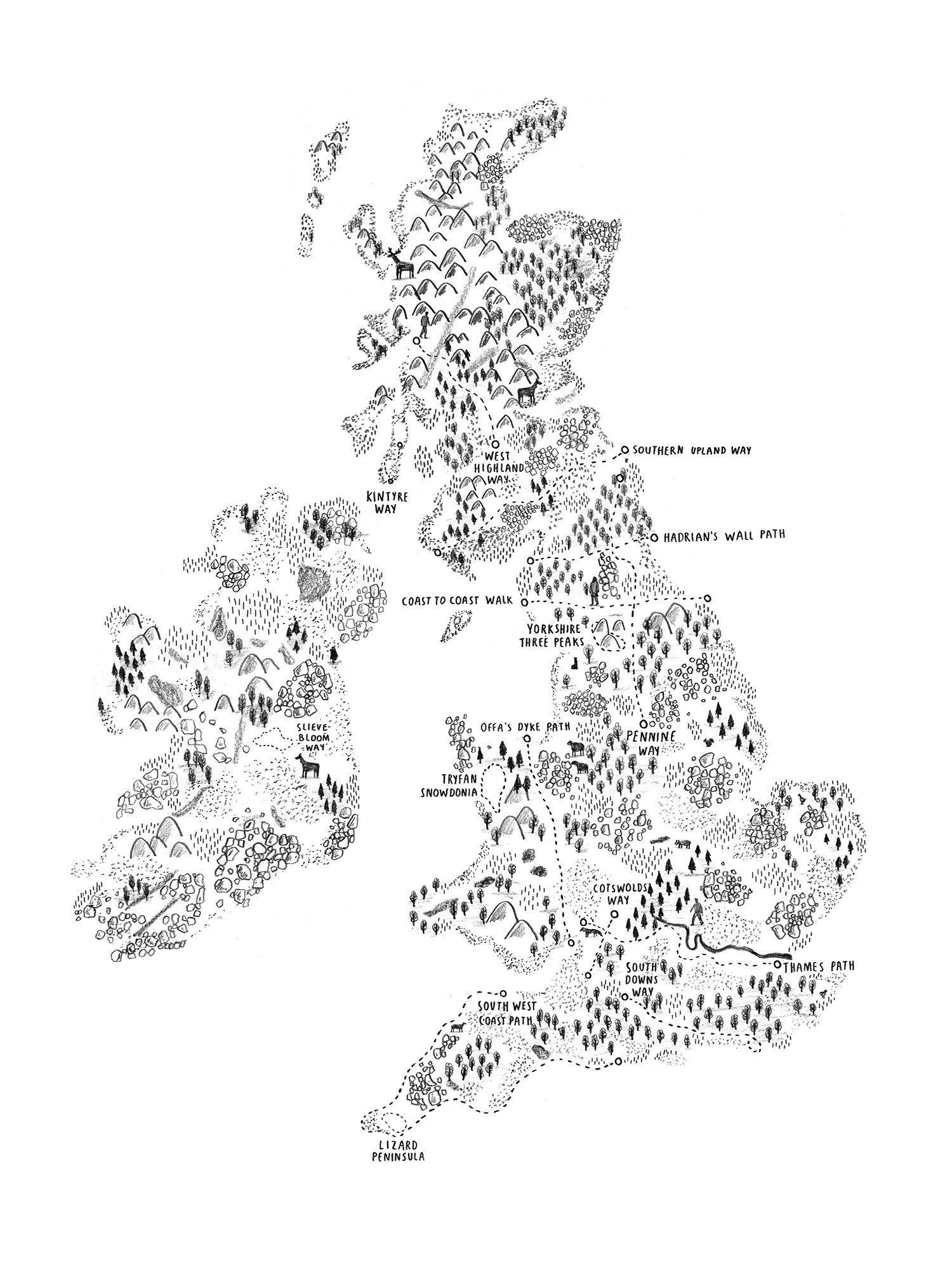
The UK & Ireland walking map

Housing development real estate map - Trinity Falls

Indianapolis beer map

Valletta map illustration
Dead on Deadline - book map illustration